No products in the cart.
Imagine Networks Greenlits FTTH Expansion After Feasibility Study
Home Imagine Networks Greenlits FTTH Expansion After Feasibility Study
- Home
- Resource Hub
- Millennium Blog
- Imagine Networks Greenlits FTTH Expansion After Feasibility Study

IMAGINE NETWORKS
GREENLITS FTTH EXPANSION AFTER FEASIBILITY STUDY
When the opportunity came knocking for network owner Josh Luthman, he and his company were eager to embrace the challenges of network expansion. After working with Millennium Geospatial engineers, who provided a feasibility study, GIS planning, and a fiber network design tailored to their network goals, Imagine Networks was prepared to start fiber construction.
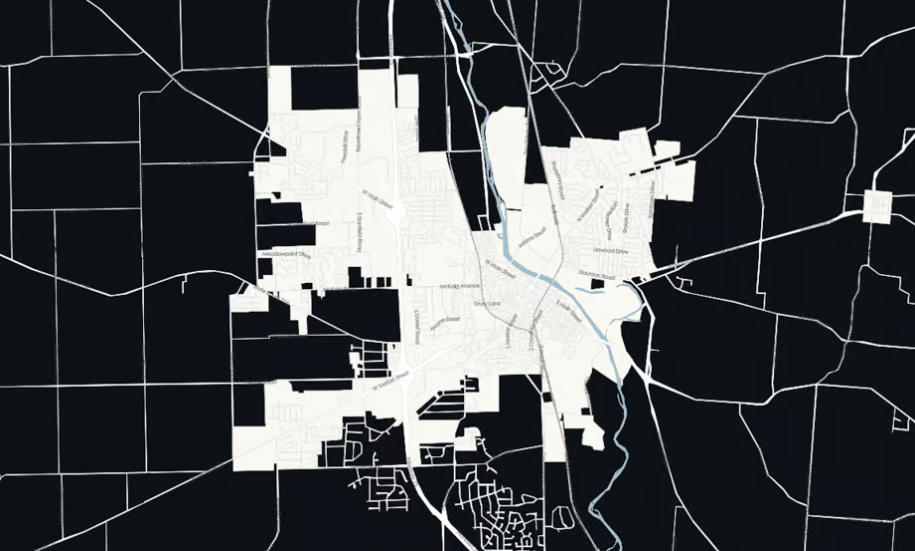
Imagine Networks, is a telecommunications company located in Troy, Ohio, that services the Miami County area. In 2019, Troy was a small, up-and-coming, city of about 25,000 people that was nestled along the “Cross-Road of America.” The city is situated close to I-70 and 1-75, two major highways that connect numerous U.S. cities, so the city experienced a healthy boom with new suburban subdivision growth and expansion that drove demand for high-speed fiber internet.
Witnessing the increase in newer subdivisions, the company realized the potential of expanding internet services to these homes. Future-focused from the get-go, Imagine Networks wanted to install a fiber optic network in these neighborhoods knowing that fiber’s reliability and speed could stand up to the ever-increasing bandwidth demands from customers.

Using a feasibility study to create a FTTH roadmap
Imagine Networks wanted to build new fiber network additions as cost-effectively and efficiently as possible and starting with a feasibility study would reveal potential ROI. Without the full spectrum of advanced GIS and network design tools at their disposal, Imagine Networks knew that collaboration with experienced geospatial engineers would be extremely beneficial.
Feasibility studies document:
Network planning in high-growth areas can be tough. Growing suburbs means utility infrastructure must also be expanded. Keeping up with all of the new growth can certainly be a challenge for utility companies, due to the many steps involved during the process such as permits and zoning.
Geospatial engineering is about pulling together and simplifying complex data like geographic barriers and existing infrastructure using GIS data mapping tools. Once data is collected, geospatial engineers apply advanced data analytics to create profitable network design plans based on a client’s goals. When you’re ready to start your fiber construction, GIS dashboards can easily and efficiently track activities like permitting and progress against high- and low-level designs. Considering the scope of the project in Troy, and all of the data needed to make informed decisions, Imagine Networks needed help with a feasibility study and fiber network design. They choose to work with experts at Millennium Geospatial.
“Coming from a Fixed Wireless Broadband business, it was most refreshing to have Millennium Geospatial engineers plan the network for us down to the foot. All Imagine Networks had to do was the field work based on their well designed routes and great choice in product. We look forward to working with them again on many more projects.”
Commissioning a FTTH feasibility study
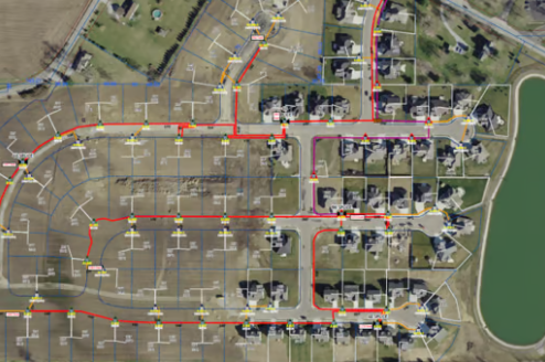
In April 2019, Josh Luthman reached out to Millennium Geospatial to learn more about what they could offer. As a part of the ESRI partner network, Millennium Geospatial has access to industry-leading GIS mapping software to transform client data into customized solutions for network growth. The team can create custom field applications and dashboards, and assist with data integration for enhanced project management. Impressed with the solutions offerings, Luthman asked Millennium Geospatial to create a high-level design for three subdivisions around Troy, Ohio.
Millennium Geospatial provided Imagine Networks with a high-level centralized split design for the three subdivisions. One subdivision consisting of about 130 homes was approved right away for further engineering. Millennium Geospatial sent a field crew to check for any necessary changes, added drop cables to the design, and then completed the fiber counts needed for splicing in November 2019. The team also provided fiber splicing documentation to aid in organizing the splicing, suggested different splicers in the area for the project, and a continuously updated map for the design as the build progressed.
Accelerating fiber network construction with Millennium ecosystem
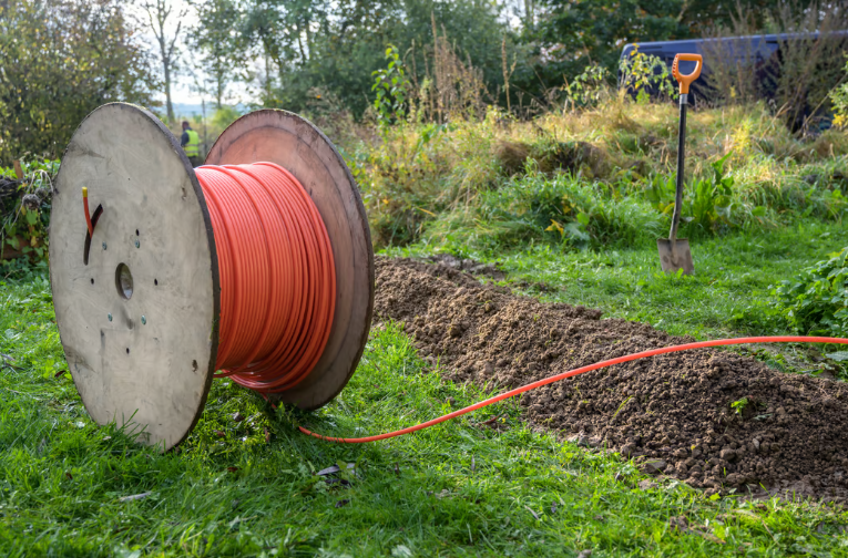
With the design finished, Imagine Networks needed materials and a construction company to complete the three buildouts. Fortunately for the team, when they partnered with Millennium Geospatial, they got access to Millennium’s entire ecosystem of end-to-end broadband solutions, so they didn’t lose momentum researching contractors and materials providers. Luthman was put in touch with Millennium’s Ohio warehouse for materials and when he asked for a recommendation for a construction company, Millennium brokered a deal with their trusted industry contact, Unite Utility, now Five Star Energy Services.

Fast-tracking expansion with a dedicated partner
By reaching out to Millennium Geospatial, Imagine Networks was able to get to market faster. After starting the construction process, Imagine Network was able to finish the project in early January 2022, after only four weeks. Imagine Networks appreciated working with a dedicated Geospatial consultant for the entire process and getting support at each phase of the project as Millennium Geospatial was able to connect the team to Millennium’s other broadband experts and other industry collaborators, expediting project completion. Happy with the project results and full project lifecycle support, Imagine Networks plans to work with Millennium in the future.
Future-Focused Network Owners from
Coast to Coast Look to Millennium For:
- Feasibility Studies & Network Design Plans
- Financing & Grants
- Project Resource Management
- Material Supply & Logistical Planning
- Equipment Leasing & Rentals