No products in the cart.
This article original appeared in our quarterly email newsletter. Not receiving our newsletter? Click here to sign up!
Alex Nelson joined our field team recently and was generous enough to share some great information about his career path as well as the work his team is doing to bring broadband to those who need and want it in a big way!
We recently got a high level overview of a GIS field engineer’s process. Can you share what you were doing with the poles in the field photos your team sent back to the office recently?
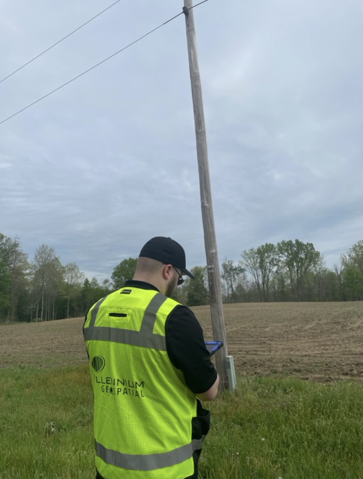
There is a lot of permitting that goes into fiber builds and we needed to submit permit requests to a power company to attach fiber to their poles in an area in Michigan. Part of the permitting process is to let the utility know where on the pole the fiber will be placed. Further, there are rules around height and distance from other wires on a pole so it’s important that we get it right.
Tell us more about the process for measuring poles for the permitting process.
It’s best/most efficient to have two people working together to measure poles. One person holds the measuring stick and collects the data and the other person operates a data collector tool. They are inputting the data as the stick person is verbally calling out the numbers. You do this for each and every pole on the route. Hopefully you’re in an area where a hotspot is operable, otherwise the data is collected manually and input later.
Working along roads, what kind of safety measures are in place?
We work during daylight hours and in pairs. We wear neon safety vests at all times. We have a magnet on the side of our vehicles identifying us to the public as well.
Is the measuring stick easy to operate?
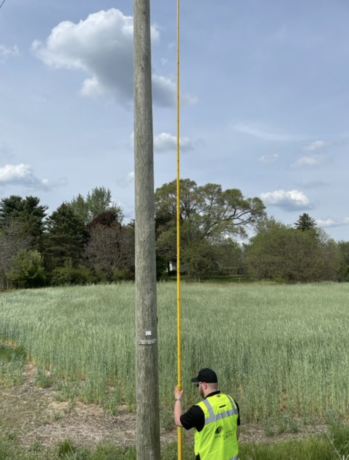
Honestly, it takes practice! Looking up and balancing the pole and focusing in on the info you need, I got a woozy, disoriented feeling at first. But your body adjusts pretty quickly and you can always take turns with your partner if needed.
Do you enjoy this part of the process?
I really do. I studied GIS in college and then in previous jobs had gotten away from the mapmaking componant and missed it a lot. I’m glad to be back doing that as part of our projects, and I’ve really enjoyed owning the permitting process for a large project that I’m working on. Building rapport with the utility companies, our clients, and the local people who frequently stop us in the field and want to learn more about what we’re doing – I really enjoy being a part of something that’s going to be very impactful in a community.
Alex Nelson is a GIS Field Engineer at Millennium Geospatial. Connect with him on LinkedIn.